Releases
Whats New in ParGo AI (V3.0 Release)
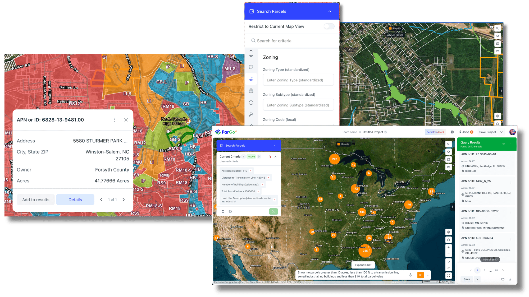
ParGo AI's Version 3.0.0 release delivers a refined user experience, intuitive AI guidance, and a new map measurement tool that enhances spatial...
Identify, plan, and deliver smarter projects by combining nationwide property data, zoning rules, permit history, and real-time change detection, all in one with ParGo AI.

Instantly analyze any parcel with zoning, environmental layers, utilities, and permit history to eliminate early-stage surprises.

Use AI-assisted spatial filters (“underbuilt parcels,” “industrial-zoned within ½ mile of transit”) to surface viable sites without manual GIS work.

Monitor ownership transfers, new permits, and construction activity in real time to anticipate competition and market shifts.

Draw or import project boundaries and instantly evaluate zoning, parcel size, setbacks, and surrounding infrastructure.→ Filter by land use, density limits, or coverage ratio to find developable lots.

Access 20 years of building permits to analyze construction trends, contractor activity, and cost benchmarks in your target area.

Overlay flood zones, wetlands, slope, and proximity to roads, utilities, or transit lines—everything you need for early-stage due diligence.

Trace from parcel to true owner through LLCs, uncovering the decision-maker’s contact info for land acquisition or JV discussions.
Receive AI alerts when nearby parcels file new permits, change hands, or list for sale—your proactive pipeline for future projects.
Generate custom “Site Readiness Reports” with zoning summary, permit timeline, comps, and owner details, exportable to Excel, ArcGIS, or Shapefile.


| Category | Sample Insights |
|---|---|
| Property & Ownership | Parcel boundaries, LLC resolution, mailing addresses, true owners |
| Zoning & Land Use | Standardized codes + allowable uses across all U.S. jurisdictions |
| Permits & Construction | 20+ years of permit data by type, value, and contractor |
| Environmental Layers | FEMA flood, wetlands, slope, soil & climate risk |
| Comps & Market Intel | Recent sales and lease transactions to benchmark values |